
I-4 Tonight, the Corridor Anchor, 17:14. Sue opens and closes it. The anchor speaks in Sue's voice, and Roger Rodger plays the operator at the traffic management centre. The voices are synthetic, the briefing is scripted, and every figure comes from Municipath's own screens.
It is Friday evening on Interstate 4. A crash has blocked the two right lanes westbound at SR 408, storm cells are drifting in from the Gulf, and a drone has just left its dock. A presenter stands in front of the corridor the way a weather anchor stands in front of the radar, and everything she touches is a Municipath screen, running (0:37).
We call her the Corridor Anchor. She is an AI presenter built into the Municipath proof of concept, the one StellarView made for Interstate 4 when it took up its own dare on October 25. This film is one scripted briefing, I-4 Tonight, recorded from the app.
She runs inside the app
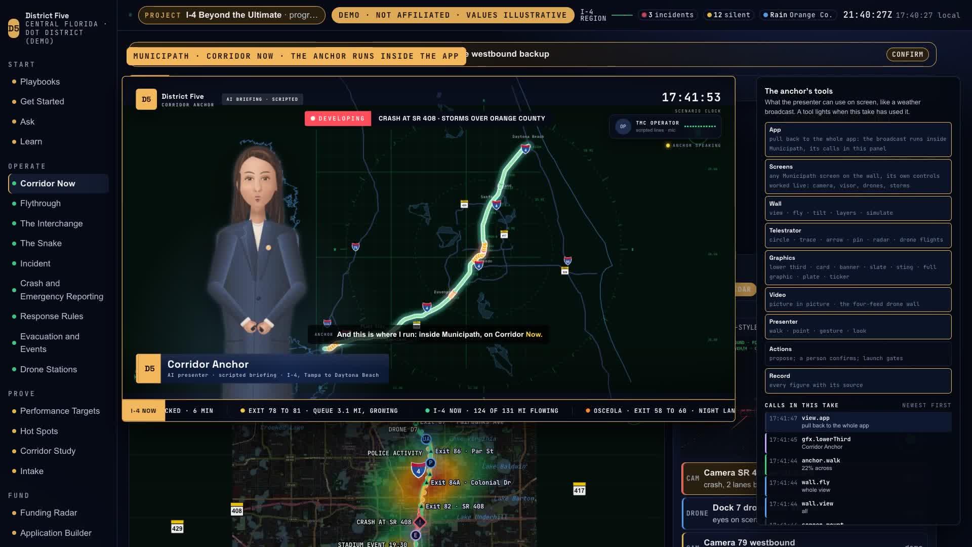
At the welcome the broadcast pulls back, and you see where it runs: inside Corridor Now, with Municipath’s menu on the left and every tool she uses listed on the right, with its time (1:49). The film pulls back like that thirteen times. When she works a control, the app’s own control comes up on screen, pressed, with its value: the camera, the visor, the snake’s easing, the evacuation’s hour, contraflow, the kind of vehicle in the lane.
What she shows
- The crash. Two lanes blocked, a queue 3.1 miles back and growing, at the corridor’s number one hot spot: 214 near misses, 11 crashes, and three times the risk in rain (2:21). She drafts a sign message for FDOT’s operator and sends it as a draft. She cannot put words on their signs herself (2:55).
- The snake. The gantries step the advised speed down, 60, then 55, then 50, so traffic eases off a mile early. It only ever slows. It never goes above the posted limit, and it never steers (3:11).
- The drones. Ten docks reach 113 of the corridor’s 131 miles inside six minutes, and Dock 6 is grounded by gusts of 31 knots against a limit of 24 (4:10). In the 3D flythrough the camera rides with a drone from its dock to what it found (4:29).
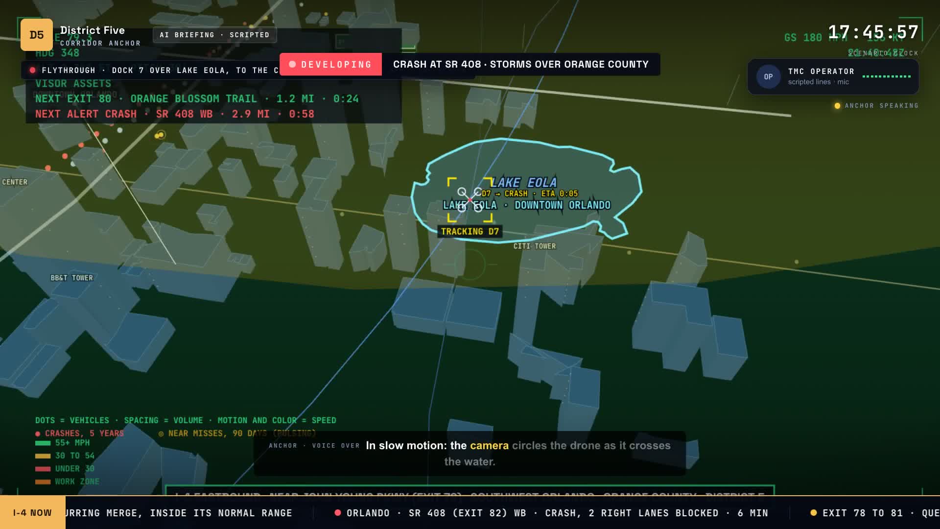
- Lake Eola. Dock 7’s path to the crash crosses Lake Eola, half a mile from I-4, in slow motion while the camera circles the drone. Then its own picture: drawn from detections, with no faces and no plates (5:46).
- The launch gate. The operator asks for a second drone. The gate holds it, because docks 6 to 9 are held for weather, and she says that is the right answer (6:40).
- The tow. No tow request is in the record, so she drafts one for the help desk, and the operator logs it. StellarView has the help desk built in, and the film shows its screens as screenshots (6:54).
- The storm and the evacuation. Storm cells move across the corridor in 3D, marked as simulated (7:39). Then the evacuation plan runs on Hurricane Milton’s conditions: 109 thousand vehicles take I-4 east, and the worst queue is 28 and a half miles. With contraflow, in the model, the queue is gone. These are the model’s numbers, and she says so (8:28).
The Funding Engine
Part four follows the same record off the road (11:30). The crash becomes its crash report, with 71 of its 77 fields filled from the record. Tonight’s easing becomes evidence in a lane-drop rain study that was registered before the easing went on. The same record reports the federal performance measures: two of the four safety measures are off target, and the report is due in 47 days.
Then it finds the money. Funding Radar reads every program and its deadline, as read on October 24: the drone inspection grants close November 15, and tonight’s flights score an 86 percent fit. The application is put together from the same record: BtU East, a $4.6 million ask that builds on the $85 million INFRA award, as reported, and 77 percent ready. One pipeline for every partner, and an Accountability screen for the audit.
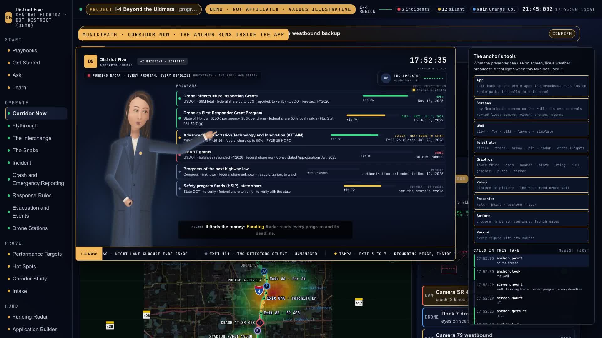
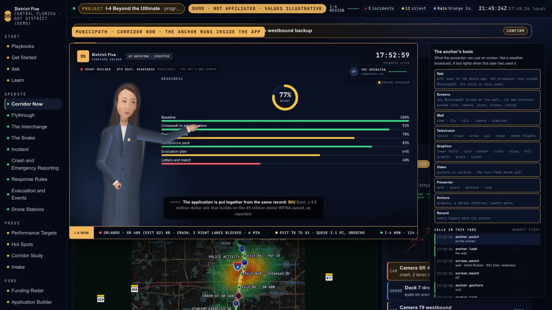
The film calls this the Funding Engine: one record, from the road to the application, and on to the report the grant asks for.
What it runs on, and who made it
The interchange takes 4,812 messages a second from 21,939 sources, and nothing fails silently (13:55). Every event travels one path: signed at the source, buffered at the edge, kept as the record. Municipath is designed to run on AWS. The rates on that screen are illustrative, and the government cloud is still an open decision.
All of it was made with StellarView: the discovery, a domain registry of 104 terms, a proof of concept of 27 screens, and requirements in 11 phases (15:14). Municipath has a help desk, Jira boards and a fleet because StellarView has them built in.
The claim
We believe Municipath is the most advanced transportation funding, research and data collection system there is. It is not built yet. What you see is the proof of concept, and the build is next. The build does not worry us. The proof of concept, and the StellarView skills behind it, have done the hard part (16:41).
What is real, and what is not yet
- The briefing is scripted. An anchor you can talk to live is not built.
- The presenter is drawn in the browser, and the voices are synthetic.
- District Five is a demo district, and the values are illustrative unless the screen marks them as real. The INFRA award is real, as reported.
- The storm cells are simulated, and the evacuation is the Evacuation screen’s own model.
- The StellarView screens are screenshots. The tow ticket was drafted on screen and not filed.
- The standards on the Accountability screen come from the domain registry StellarView generated, and an expert still has to review it.